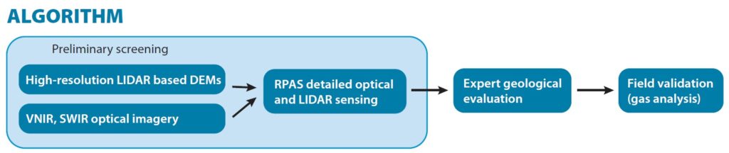
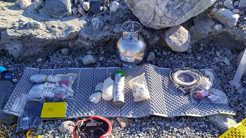
We provide screening of even large areas to indicate potential natural hydrogen leakages. Our method based on numerical geomorphology and optical and thermal imagery is especially effective in sedimentary basins. We analyze satellite, airborne and Remotely Piloted Aircraft Systems imagery (RPAS) by both deterministic and machine learning methods. Our service can also include geological expertise of local geological conditions and field measurements of natural soil gases. This screening is saving lot of resources and helping to focus following more expensive geophysical and drilling methods to specific small areas.